Escape the hustle, leave your phone at home and experience the unspoiled wilderness in the heart of the South where the landscape takes charge. Explore some of the best tracks in the world on a multi-day hiking adventure around glassy lakes, towering mountains and national parks.

Three of New Zealand's Great Walks are accessible from Queenstown, including the renowned Routeburn Track which starts from Glenorchy. There is an abundance of other awe-inspiring multi-day hikes in and around Mt Aspiring National Park waiting to be explored, with informationtrack transport, guided options and gear hire all at your fingertips.


When’s the best time to go?

The walking season runs from the end of October to the end of April, with the peak season being January and February. If you want to avoid the crowds, book in November or March/April - you’ll still get nice long days for hiking.


How to book the hiking trails

The Great Walks

Queenstown is close to three of Aotearoa’s nine Great Walks, and bookings are handled by the Department of Conservation (DOC). You can book a bunk in the DOC huts online, and the Kepler and the Routeburn Tracks also offer campsites.

There’s also the option to walk with a guide, offering an opportunity to learn more about the flora, fauna and history as you make your way through these secluded pockets of the world. For those new to hiking, a guide can offer extra peace of mind for navigating the depths of New Zealand’s wild places. Queenstown has got plenty of friendly local operators to choose from, including some who offer private lodges on the Routeburn and Milford.

Other multi-day hikes around Queenstown

Other walks, like the Greenstone Caples and Rees-Dart tracks, do not require bookings for the huts but it's a 'first-in-first-served' for the bunks. Visitors need to purchase tickets from the Department of Conservation (DOC) visitor centre before you go.

Now you know how to secure your bunk, let’s explore your options.
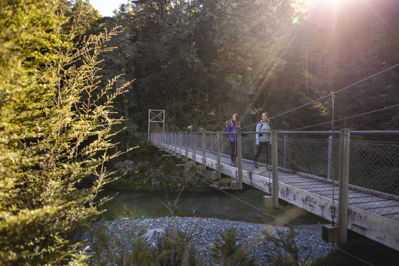
Two female hikers on the Routeburn Track swing bridgeRouteburn Track

The Milford Track

Distance: 54 kms

Hiking time: 4 days

Elevation: The highest point is Mackinnon Pass, 1,140 m (3,740 ft)

The Milford Sound Track has been dubbed ‘the finest walk in the world’, and for good reason. It’s a stunning exploration of the Fiordland National Park, through glacier-carved valleys, soaring waterfalls and New Zealand’s iconic native rainforest. The track follows the Clinton River before ascending Mackinnon Pass, where the views from the top leave your jaw on the floor and take the words from your lips.

From here descend into Milford Sound, where a side trip to Sutherland Falls is not to be missed. The Milford Sound hike is the most popular Great Walk, and we recommend booking six months in advance. Add a Milford Sound cruise on to your hiking trip to see this unique southern wilderness from a whole different angle.

How to get here: Scheduled buses and hiker shuttles run from Queenstown to Te Anau (two hours). For self-drivers, there are vehicle relocation and vehicle storage options available. It’s another 30-minute drive to Te Anau Downs, the launching point for the scenic boat trip to the head of Lake Te Anau, where the track starts. The trail ends at Sandfly Point, a 15-minute boat ride from Milford Sound, where shuttles collect walkers for the spectacular drive back.

Or, opt for an all-inclusive guided hike, and embark on an unforgettable journey through New Zealand's most remote national park.

Visit the Destination Fiordland website for more information about Te Anau and Fiordland National Park.


The Kepler Track

Distance: 60 kms

Hiking time: 3-4 days

Elevation: The highest point is Luxmore Saddle 1,400 m (4,600 ft)

Traversing impressive ridgelines and saddles, the Kepler Track keeps you soaring high above the bush line, looking down over ever-changing views of Lake Te Anau and Fiordland National Park. The loop track includes many magical side trips to caves, waterfalls, moss-covered forest, wetlands and a rocky valley scarred by an old rockslide.

Kepler Track day walks are also popular, though the richness of the land will have you believing you’ve been immersed for days.

How to get here: Scheduled buses and hiker shuttles run from Queenstown to Te Anau. For self-drivers, there are both vehicle relocation and storage options available. Shuttles provide connections to the start/finish point, just 5 km from Te Anau.

For more information on Te Anau and surrounds, visit the Destination Fiordland website.


The Routeburn Track

Distance: 32 kms

Hiking time: 2-4 days

Elevation: The highest point is near Harris Saddle 1,300 m (4,300 ft)

Named one of the ‘best hikes in the world’ by Lonely Planet, the Routeburn offers remote primeval wilderness at its finest. It’s a bridge between two very special places, linking the Mt Aspiring National Park with Fiordland National Park, and will take you wandering through lush native forest, past crashing waterfalls and high into the peaks.

The Routeburn can also be joined with either the Greenstone or Caples Tracks to make a near-loop back to Lake Whakatipu.

How to get here: Most people start the Routeburn at the eastern trailhead, just beyond Glenorchy, two hours’ drive from Queenstown. The end is at the Divide on the Te Anau–Milford Highway, around four hours from Queenstown. Shuttle operators can offer round trips and vehicle relocation options offer a flexible option for making the most of your travel itinerary. 

There is also a guided option on the multi-day walk.

There is no cell phone coverage or Wi-Fi on the track, or at either car park so plan your track transport in advance.


The Greenstone Track and Caples Track

Distance: 51kms

Hiking time: 4 days

Elevation: The highest point is McKellar Saddle 945m (3,100ft)

These two tracks run up parallel valleys to form a loop, linked by the McKellar Saddle. Whilst the Greenstone Valley is an expansive open valley with tussock flats and beech forest, the Caples Valley is narrower, with dense forest and grassy clearings.

Bookings aren’t required for most of the huts, but you’ll need to buy a hut pass from DOC office. The Mid Greenstone Hut and Upper Caples Hut are run by the NZ Deerstalkers Association and you can book these online.

How to get here: Either of these tracks can be linked with the Routeburn Track, or they can be walked as a one-way track starting or finishing either at the Divide or the Greenstone Shelter. Shuttle transport and car relocation services can be organised for both.


The Grand Traverse - a combination of The Greenstone and Routeburn Tracks

Distance: 66km

Hiking time: 5-6 days

Elevation: The highest point is near Harris Saddle 1,300 m (4,300 ft)

The Grand Traverse starts on the shores of Lake Whakatipu and stretches the length of the Greenstone and Routeburn Valleys, crossing the main divide twice and passing through both Fiordland and Mount Aspiring national parks. Starting on the Greenstone track, you'll cross through wide open valleys with tussock flats and beech forests before you head up and meet The Routeburn track at Lake Howden. Continue alongside picturesque reflective tarns and alpine gardens and follow The Routeburn Track out to finish at The Routeburn Shelter.

Bookings aren't required for most of the huts on the Greenstone leg but you'll need to buy hut tickets from the DOC office to pay for your stay. The Mid Greenstone Hut is run by the NZ Deerstalkers Association and you can book this online. When you reach the Routeburn, you'll need to have prebooked your spot with DOC so you don't get stuck without a bed.

The Grand Traverse is also offered as a 6-day/5-night all-inclusive guided hike, including transport, accommodation, meals and backpacks.

How to get here: The Greenstone track starts from the car park at the end of Greenstone Road, 86km from Queenstown, via Glenorchy. For an extra something special explore the Lake Rere walkway at the start of the Greenstone track before heading up towards Greenstone Hut.  


The Rees-Dart Track 

Distance: 63km

Hiking time: 4-5 days

Elevation: The highest point is the Rees Saddle, 1471m (4,826ft)

These tracks pierce straight into the breathtaking Mt Aspiring National Park, running through the Rees and Dart Valleys and linking the two. There are three huts, which are first-come-first-serve (though you’ll need to buy a backcountry hut pass at a DOC office), and you can camp anywhere apart from between Shelter Rock Hut and Dart Hut. 

Side trips (like up to the Dart Glacier) will offer spectacular views, but these can be technical and dangerous, so check the conditions and read more on the DOC website to find out whether it will suit your ability.

How to get here: The Rees track starts at the Muddy Creek carpark, 68kms from Queenstown past Glenorchy. The Dart track starts either at Chinaman’s Flat (76km from Queenstown) or, if the road is in flood, from Paradise, which adds another 6kms to your hike. Transport options are aplenty - as well as shuttles and car transfers, jet boats also service the Dart river.